
Articles | Volume 15, issue 9
https://doi.org/10.5194/se-15-1155-2024
© Author(s) 2024. This work is distributed under
the Creative Commons Attribution 4.0 License.
the Creative Commons Attribution 4.0 License.
https://doi.org/10.5194/se-15-1155-2024
© Author(s) 2024. This work is distributed under
the Creative Commons Attribution 4.0 License.
the Creative Commons Attribution 4.0 License.
Research article
| 
18 Sep 2024
Research article |
| 18 Sep 2024
| 18 Sep 2024
Anatomy of a fumarole field: drone remote-sensing and petrological approaches reveal the degassing and alteration structure at La Fossa cone, Vulcano, Italy
Daniel Müller
CORRESPONDING AUTHOR

GFZ German Research Centre for Geosciences, 14473 Telegrafenberg, Potsdam, Germany
Thomas R. Walter
GFZ German Research Centre for Geosciences, 14473 Telegrafenberg, Potsdam, Germany
Valentin R. Troll
Department of Earth Sciences, Natural Resources and Sustainable Development, Uppsala University, Uppsala, Sweden
Istituto Nazionale di Geofisica e Vulcanologia (INGV), Rome, Italy
Jessica Stammeier
GFZ German Research Centre for Geosciences, 14473 Telegrafenberg, Potsdam, Germany
Andreas Karlsson
Department of Geosciences, Swedish Museum of Natural History, Box 50007, 104 05 Stockholm, Sweden
Erica de Paolo
Department of Earth and Environmental Sciences, University of Milano-Bicocca, Piazza della Scienza 4, 20126 Milan, Italy
Antonino Fabio Pisciotta
Istituto Nazionale di Geofisica e Vulcanologia (INGV), Palermo, Italy
Martin Zimmer
GFZ German Research Centre for Geosciences, 14473 Telegrafenberg, Potsdam, Germany
Benjamin De Jarnatt
GFZ German Research Centre for Geosciences, 14473 Telegrafenberg, Potsdam, Germany
Related authors
Alina V. Shevchenko, Eduardo Freitas, Christian Wimmer, Egill Á. Gudnason, Magnus T. Gudmundsson, Gro B. M. Pedersen, Luciano P. de Oliveira, Magdalena S. Vassileva, Daniel Müller, Dibakar K. Ritushree, Mahdi Motagh, Thomas R. Walter, João Moreira, Martin Herold, Frieder M. Knabe, Gian C. Oré Huacles, and Hugo E. Hernandez-Figueroa
Int. Arch. Photogramm. Remote Sens. Spatial Inf. Sci., XLIX-B3-2026, 257–263, https://doi.org/10.5194/isprs-archives-XLIX-B3-2026-257-2026, https://doi.org/10.5194/isprs-archives-XLIX-B3-2026-257-2026, 2026
Alina V. Shevchenko, Eduardo Freitas, Christian Wimmer, Egill Á. Gudnason, Magnus T. Gudmundsson, Gro B. M. Pedersen, Luciano P. de Oliveira, Magdalena S. Vassileva, Daniel Müller, Dibakar K. Ritushree, Mahdi Motagh, Thomas R. Walter, João Moreira, Martin Herold, Frieder M. Knabe, Gian C. Oré Huacles, and Hugo E. Hernandez-Figueroa
Int. Arch. Photogramm. Remote Sens. Spatial Inf. Sci., XLIX-B3-2026, 257–263, https://doi.org/10.5194/isprs-archives-XLIX-B3-2026-257-2026, https://doi.org/10.5194/isprs-archives-XLIX-B3-2026-257-2026, 2026
Dan Holtstam, Fernando Cámara, and Andreas Karlsson
Eur. J. Mineral., 38, 169–177, https://doi.org/10.5194/ejm-38-169-2026, https://doi.org/10.5194/ejm-38-169-2026, 2026
Short summary
Short summary
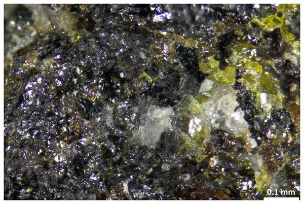
Friisite is a newly identified mineral, with the chemical formula Pb8Al3Si8O27Cl3, from the Långban mine in Sweden, found as tiny, white, flaky grains within a skarn matrix alongside jagoite and other silicates. It has a sub-adamantine luster, perfect basal cleavage, a hardness of 4–5, and a high density of 5.54 g cm−³. Structurally it is a hexagonal phyllosilicate, closely related to jagoite in a polysomatic series. The mineral is named in honor of Danish mineralogist Henrik Friis.
Ellen Schnabel, Jessica A. Stammeier, Stefanie Poetz, Kai Mangelsdorf, Aurèle Vuillemin, Rolando di Primio, Jens Kallmeyer, and the PROSPECTOMICS Consortium
Biogeosciences, 23, 1383–1401, https://doi.org/10.5194/bg-23-1383-2026, https://doi.org/10.5194/bg-23-1383-2026, 2026
Short summary
Short summary
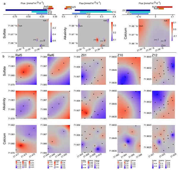
Even minor hydrocarbon seepage from reservoirs into overlying seafloor can affect marine sediment biogeochemistry. Our analysis of 50 sediment cores from the Barents Sea revealed that subtle seepage alters chemical balances and stimulates carbonate and sulfide mineral formation. The cores also showed strong local and spatial variation, highlighting patchy migration pathways. Minerals and pore water chemistry together provide clues to identify both past and ongoing seepage activity.
Massimiliano Guastella, Antonino Pisciotta, Raffaele Martorana, and Antonino D’Alessandro
Int. Arch. Photogramm. Remote Sens. Spatial Inf. Sci., XLVIII-M-7-2025, 169–179, https://doi.org/10.5194/isprs-archives-XLVIII-M-7-2025-169-2025, https://doi.org/10.5194/isprs-archives-XLVIII-M-7-2025-169-2025, 2025
Dan Holtstam, Fernando Cámara, Henrik Skogby, Andreas Karlsson, and Alessandro De Leo
Eur. J. Mineral., 37, 221–231, https://doi.org/10.5194/ejm-37-221-2025, https://doi.org/10.5194/ejm-37-221-2025, 2025
Short summary
Short summary
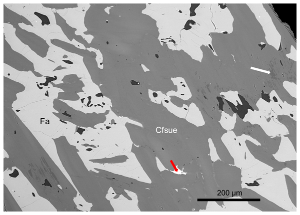
The mineral clino-ferro-suenoite, with the chemical formula ◻Mn2Fe2+5Si8O22(OH)2, was historically named “dannemorite” or “manganogrunerite” and is a member of the amphibole supergroup. It is now formally approved by the International Mineralogical Association. It occurs in iron–manganese-bearing rock from the Hilläng mines, Dalarna, Sweden, and is associated with the minerals fayalite, spessartine, ferro-actinolite, calcite, magnetite and pyrite. It formed by replacement of Mn-bearing fayalite.
Gabrielle Rodrigues de Faria, David Lazarus, Johan Renaudie, Jessica Stammeier, Volkan Özen, and Ulrich Struck
Clim. Past, 20, 1327–1348, https://doi.org/10.5194/cp-20-1327-2024, https://doi.org/10.5194/cp-20-1327-2024, 2024
Short summary
Short summary
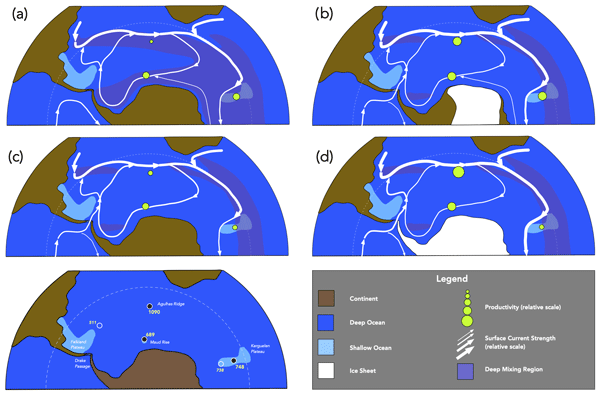
Export productivity is part of the global carbon cycle, influencing the climate system via biological pump. About 34 million years ago, the Earth's climate experienced a climate transition from a greenhouse state to an icehouse state with the onset of ice sheets in Antarctica. Our study shows important productivity events in the Southern Ocean preceding this climatic shift. Our findings strongly indicate that the biological pump potentially played an important role in that past climate change.
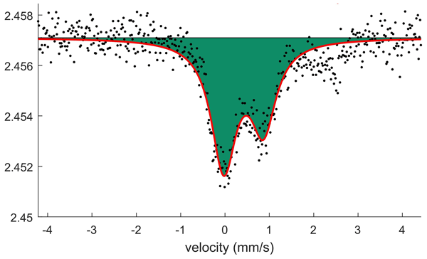
Dan Holtstam, Jörgen Langhof, Henrik Friis, Andreas Karlsson, and Muriel Erambert
Eur. J. Mineral., 36, 311–322, https://doi.org/10.5194/ejm-36-311-2024, https://doi.org/10.5194/ejm-36-311-2024, 2024
Short summary
Short summary
We described two new minerals, igelströmite and manganoschafarzikite, from the Långban manganese–iron deposit in Värmland, Sweden. The chemical formulae are Fe3+(Sb3+Pb2+)O4 and Mn2+Sb3+2O4, respectively. They belong to a new mineral group, where all members have the same crystal structure. It is called the minium group, after the lead-oxide mineral that is the oldest known substance of this kind.

Tomáš Fischer, Pavla Hrubcová, Torsten Dahm, Heiko Woith, Tomáš Vylita, Matthias Ohrnberger, Josef Vlček, Josef Horálek, Petr Dědeček, Martin Zimmer, Martin P. Lipus, Simona Pierdominici, Jens Kallmeyer, Frank Krüger, Katrin Hannemann, Michael Korn, Horst Kämpf, Thomas Reinsch, Jakub Klicpera, Daniel Vollmer, and Kyriaki Daskalopoulou
Sci. Dril., 31, 31–49, https://doi.org/10.5194/sd-31-31-2022, https://doi.org/10.5194/sd-31-31-2022, 2022
Short summary
Short summary
The newly established geodynamic laboratory aims to develop modern, comprehensive, multiparameter observations at depth for studying earthquake swarms, crustal fluid flow, mantle-derived fluid degassing and processes of the deep biosphere. It is located in the West Bohemia–Vogtland (western Eger Rift) geodynamic region and comprises a set of five shallow boreholes with high-frequency 3-D seismic arrays as well as continuous real-time fluid monitoring at depth and the study of the deep biosphere.
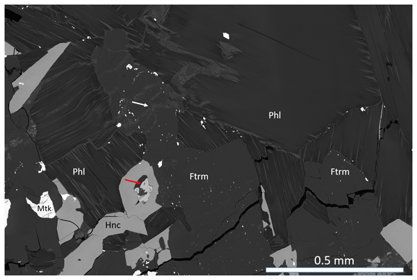
Dan Holtstam, Fernando Cámara, Andreas Karlsson, Henrik Skogby, and Thomas Zack
Eur. J. Mineral., 34, 451–462, https://doi.org/10.5194/ejm-34-451-2022, https://doi.org/10.5194/ejm-34-451-2022, 2022
Short summary
Short summary
A new mineral has been discovered, an amphibole, with the name ferri-taramite, which has now been approved by the International Mineralogical Association. The paper discusses the significance of the discovery in relation to other amphiboles found worldwide. This taramite is unique in that it is from a skarn associated with ore and is not of magmatic origin. For the description we have used many methods, including X-ray diffraction, chemical analyses and several types of spectroscopy.
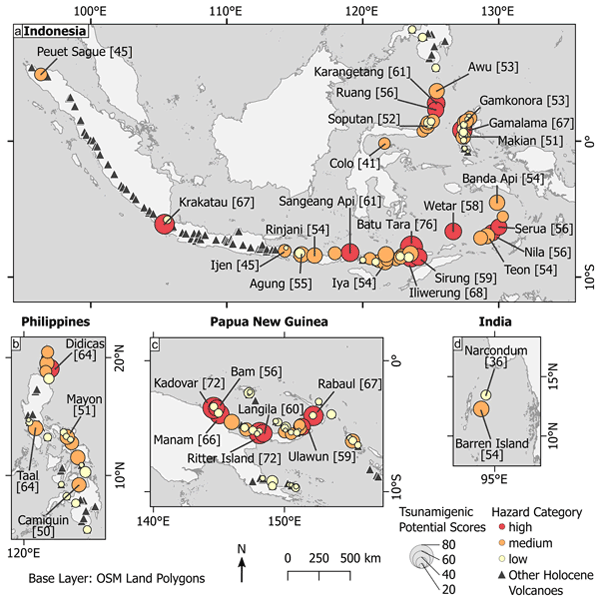
Edgar U. Zorn, Aiym Orynbaikyzy, Simon Plank, Andrey Babeyko, Herlan Darmawan, Ismail Fata Robbany, and Thomas R. Walter
Nat. Hazards Earth Syst. Sci., 22, 3083–3104, https://doi.org/10.5194/nhess-22-3083-2022, https://doi.org/10.5194/nhess-22-3083-2022, 2022
Short summary
Short summary
Tsunamis caused by volcanoes are a challenge for warning systems as they are difficult to predict and detect. In Southeast Asia there are many active volcanoes close to the coast, so it is important to identify the most likely volcanoes to cause tsunamis in the future. For this purpose, we developed a point-based score system, allowing us to rank volcanoes by the hazard they pose. The results may be used to improve local monitoring and preparedness in the affected areas.

Alessandro Gattuso, Francesco Italiano, Giorgio Capasso, Antonino D'Alessandro, Fausto Grassa, Antonino Fabio Pisciotta, and Davide Romano
Nat. Hazards Earth Syst. Sci., 21, 3407–3419, https://doi.org/10.5194/nhess-21-3407-2021, https://doi.org/10.5194/nhess-21-3407-2021, 2021
Short summary
Short summary
Santa Barbara and Aragona are affected by mud volcanism with episodic hazardous paroxysm events. Two potentially hazardous paroxysm exposed surfaces of 0.12 and 0.20 km2 were elaborated with DSMs and with historical information on the paroxysms that occurred in the past. This paper, in the end, could be a useful tool for civil protection authorities in order to take appropriate risk mitigation measurements for exposed people and for monitoring activities.
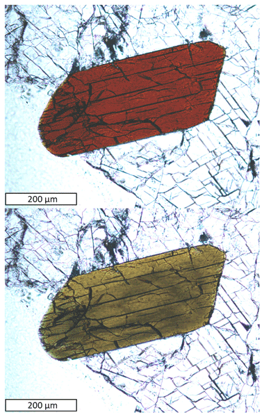
Fernando Cámara, Dan Holtstam, Nils Jansson, Erik Jonsson, Andreas Karlsson, Jörgen Langhof, Jaroslaw Majka, and Anders Zetterqvist
Eur. J. Mineral., 33, 659–673, https://doi.org/10.5194/ejm-33-659-2021, https://doi.org/10.5194/ejm-33-659-2021, 2021
Short summary
Short summary
Zinkgruvanite, a barium manganese iron silicate with sulfate, is a new mineral found in drill core samples from the Zinkgruvan zinc, lead and silver mine in Sweden. It is associated with other minerals like baryte, barytocalcite, diopside and sulfide minerals. It occurs as flattened and elongated crystals up to 1 mm. It is almost black. Zinkgruvanite is closely related to the mineral yoshimuraite and based on its crystal structure, grouped with the ericssonite group of minerals.
Cited articles
Abdi, H. and Williams, L. J.: Principal component analysis, WIREs Comput. Stat., 2, 433–459, https://doi.org/10.1002/wics.101, 2010.
Aiuppa, A., Federico, C., Giudice, G., and Gurrieri, S.: Chemical mapping of a fumarolic field: La Fossa crater, Vulcano Island (Aeolian Islands, Italy), Geophys. Res. Lett., 32, 13, https://doi.org/10.1029/2005GL023207, 2005.
Alexandris, N., Gupta, S., and Koutsias, N.: Remote sensing of burned areas via PCA, Part 1; centering, scaling and EVD vs SVD, Open Geospat. Data, Softw. Stand., 2, 1–11, https://doi.org/10.1186/s40965-017-0028-1, 2017.
Azzarini, F. M., Pareschi, M. T., Sbrana, A., Favalli, M., and Fulignati, P.: Surface hydrothermal alteration mapping at Vulcano Island using MIVIS data, Int. J. Remote Sens., 22, 2045–207, https://doi.org/10.1080/01431160118291, 2001.
Ball, M. and Pinkerton, H.: Factors affecting the accuracy of thermal imaging cameras in volcanology, J. Geophys. Res.-Sol. Ea., 111, https://doi.org/10.1029/2005JB003829, 2006.
Barreca, G., Bruno, V., Cultrera, F., Mattia, M., Monaco, C., and Scarfì, L.: New insights in the geodynamics of the Lipari-Vulcano area (Aeolian Archipelago, southern Italy) from geological, geodetic and seismological data, J. Geodyn., 82, 150–167, https://doi.org/10.1016/j.jog.2014.07.003, 2014.
Berg, S. E., Troll, V. R., Harris, C., Deegan, F. M., Riishuus, M. S., Burchardt, S., and Krumbholz, M.: Exceptionally high whole-rock δ18O values in intra-caldera rhyolites from Northeast Iceland, Mineral. Mag., 82, 1147–1168, https://doi.org/10.1180/mgm.2018.114, 2018.
Billi, A., Barberi, G., Faccenna, C., Neri, G., Pepe, F., and Sulli, A.: Tectonics and seismicity of the Tindari Fault System, southern Italy: Crustal deformations at the transition between ongoing contractional and extensional domains located above the edge of a subducting slab, Tectonics, 25, 2, https://doi.org/10.1029/2004TC001763, 2006.
Bolognesi, L. and D'Amore, F.: Isotopic variation of the hydrothermal system on Vulcano Island, Italy, Geochim. Cosmochim. Ac., 57, 2069–2082, https://doi.org/10.1016/0016-7037(93)90094-D, 1993.
Boyce, A. J., Fulignati, P., Sbrana, A., and Fallick, A. E.: Fluids in early stage hydrothermal alteration of high-sulfidation epithermal systems: A view from the Vulcano active hydrothermal system (Aeolian Island, Italy), J. Volcanol. Geoth. Res., 166, 76–90, https://doi.org/10.1016/j.jvolgeores.2007.07.005, 2007.
Bukumirovic, T., Italiano, F., and Nuccio, P. M.: The evolution of a dynamic geological system: the support of a GIS for geochemical measurements at the fumarole field of Vulcano, Italy, J. Volcanol. Geoth. Res., 79, 253–263, https://doi.org/10.1016/S0377-0273(97)00032-2, 1997.
Capasso, G., Favara, R., and Inguaggiato, S.: Chemical features and isotopic composition of gaseous manifestations on Vulcano Island, Aeolian Islands, Italy: an interpretative model of fluid circulation. Geochim. Cosmochim. Ac., 61, 3425–3440, https://doi.org/10.1016/S0016-7037(97)00163-4, 1997.
Capasso, G., Favara, R., and Inguaggiato, S.: Interaction between fumarolic gases and thermal groundwaters at Vulcano Island (Italy): evidences from chemical composition of dissolved gases in waters, J. Volcanol. Geoth. Res., 102, 309–318, https://doi.org/10.1016/S0377-0273(00)00193-1, 2000.
Capasso, G., Federico, C., Madonia, P., and Paonita, A.: Response of the shallow aquifer of the volcano-hydrothermal system during the recent crises at Vulcano Island (Aeolian Archipelago, Italy), J. Volcanol. Geoth. Res., 273, 70–80, https://doi.org/10.1016/j.jvolgeores.2014.01.005, 2014.
Carapezza, M. L., Barberi, F., Ranaldi, M., Ricci, T., Tarchini, L., Barrancos, J., Fischer, C., Perez, N., Weber, K., Di Piazza, A., and Gattuso, A.: Diffuse CO2 soil degassing and CO2 and H2S concentrations in air and related hazards at Vulcano Island (Aeolian arc, Italy). J. Volcanol. Geoth. Res., 207, 130–144, https://doi.org/10.1016/j.jvolgeores.2011.06.010, 2011.
Carranza, E. J. M. and Hale, M.: Mineral imaging with Landsat Thematic Mapper data for hydrothermal alteration mapping in heavily vegetated terrane, Int. J. Remote Sens., 23, 4827–4852, https://doi.org/10.1080/01431160110115014, 2002.
Chiodini, G., Cioni, R., and Marini, L.: Reactions governing the chemistry of crater fumaroles from Vulcano Island, Italy, and implications for volcanic surveillance, Appl. Geochem., 8, 357–371, https://doi.org/10.1016/0883-2927(93)90004-Z, 1993.
Chiodini G., Cioni R., Marini L., and Panichi C.: Origin of fumarolic fluids of Vulcano Island, Italy and implications for volcanic surveillance, B. Volcanol., 57, 99–110, https://doi.org/10.1007/BF00301400, 1995.
Chiodini, G., Frondini, F., and Raco, B.: Diffuse emission of CO 2 from the Fossa crater, Vulcano Island (Italy), B. Volcanol., 58, 41–50, https://doi.org/10.1007/s004450050124, 1996.
Chiodini, G., Allard, P., Caliro, S., and Parello, F.: 18O exchange between steam and carbon dioxide in volcanic and hydrothermal gases: Implications for the source of water, Geochim. Cosmochim. Ac., 64, 2479–2488, https://doi.org/10.1016/S0016-7037(99)00445-7, 2000.
Chiodini, G., Granieri, D., Avino, R., Caliro, S., Costa, A., and Werner, C.: Carbon dioxide diffuse degassing and estimation of heat release from volcanic and hydrothermal systems, J. Geophys. Res.-Sol. Ea., 110, B8, https://doi.org/10.1029/2004JB003542, 2005.
Chiodini, G., Caliro, S., Lowenstern, J. B., Evans, W. C., Bergfeld, D., Tassi, F., and Tedesco, D.: Insights from fumarole gas geochemistry on the origin of hydrothermal fluids on the Yellowstone Plateau, Geochim. Cosmochim. Ac., 89, 265–278, https://doi.org/10.1016/j.gca.2012.04.051, 2012.
Clarke, A. B., Ongaro, T. E., and Belousov, A.: Vulcanian eruptions, in: The encyclopedia of volcanoes, Academic Press, 505–518, https://doi.org/10.1016/B978-0-12-385938-9.00028-6, 2015.
Coppola, D., Laiolo, M., Campus, A., and Massimetti, F.: Thermal unrest of a fumarolic field tracked using VIIRS imaging bands: The case of La Fossa crater (Vulcano Island, Italy), Front. Earth Sci., 10, 964372, https://doi.org/10.3389/feart.2022.964372, 2022.
Cultrera, F., Barreca, G., Ferranti, L., Monaco, C., Pepe, F., Passaro, S., Barberi, G., Bruno, V., Burrato, P., Mattia, M., Musumeci, C., and ScarfÌ L.: Structural architecture and active deformation pattern in the northern sector of the Aeolian–Tindari–Letojanni fault system (SE Tyrrhenian Sea-NE Sicily) from integrated analysis of field, marine geophysical, seismological and geodetic data, Ital. J. Geosci., 136, 399–417, https://doi.org/10.3301/IJG.2016.17, 2017.
Darmawan, H., Troll, V. R., Walter, T. R., Deegan, F. M., Geiger, H., Heap, M. J., Searphine, N., Harris, C., Humaida, H., and Müller, D.: Hidden mechanical weaknesses within lava domes provided by buried high-porosity hydrothermal alteration zones, Sci. Rep.-UK, 12, 3202, https://doi.org/10.1038/s41598-022-06765-9, 2022.
De Astis, G., La Volpe, L., Peccerillo, A., and Civetta, L.: Volcanological and petrological evolution of Vulcano island (Aeolian Arc, southern Tyrrhenian Sea), J. Geophys. Res.-Sol. Ea., 102, 8021–8050, https://doi.org/10.1029/96JB03735, 1997.
De Astis, G., Lucchi, F., Dellino, P., La Volpe, L., Tranne, C. A., Frezzotti, M. L., and Peccerillo, A.: Chapter 11 Geology, volcanic history and petrology of Vulcano (central Aeolian archipelago), Geol. Soc. Lond. Mem., 37, 281–349, https://doi.org/10.1144/M37.11, 2013.
Diliberto, I., Pedone, M., Jácome Paz, M., Inguaggiato, S., Mazot, A., Cangemi, M., and Pisciotta, A. F.: Volcanic Gas Hazard Assessment in the Baia di Levante Area (Vulcano Island, Italy) Inferred by Geochemical Investigation of Passive Fluid Degassing, Geosciences, 11, 478, https://doi.org/10.3390/geosciences11110478, 2021.
Diliberto, I. S.: Time series analysis of high temperature fumaroles monitored on the island of Vulcano (Aeolian Archipelago, Italy), J. Volcanol. Geoth. Res., 264, 150–163, https://doi.org/10.1016/j.jvolgeores.2013.08.003, 2013.
Diliberto, I. S.: Long-term monitoring on a closed-conduit volcano: A 25 year long time-series of temperatures recorded at La Fossa cone (Vulcano Island, Italy), ranging from 250 °C to 520 °C, J. Volcanol. Geoth. Res., 346, 151–160, https://doi.org/10.1016/j.jvolgeores.2017.03.005, 2017.
Di Tommaso, I. and Rubinstein, N.: Hydrothermal alteration mapping using ASTER data in the Infiernillo porphyry deposit, Argentina, Ore Geol. Rev., 32, 275–290, https://doi.org/10.1016/j.oregeorev.2006.05.004, 2007.
Donoghue, E., Troll, V. R., Harris, C., O'Halloran, A., Walter, T. R., and Torrado, F. J. P.: Low-temperature hydrothermal alteration of intra-caldera tuffs, Miocene Tejeda caldera, Gran Canaria, Canary Islands, J. Volcanol. Geoth. Res., 176, 551–564, https://doi.org/10.1016/j.jvolgeores.2008.05.002, 2008.
Donoghue, E., Troll, V. R., and Harris, C.: Fluid–rock interaction in the Miocene, Post-Caldera, Tejeda intrusive complex, Gran Canaria (Canary Islands): insights from mineralogy, and O-and H-isotope geochemistry, J. Petrol., 51, 2149–2176, https://doi.org/10.1093/petrology/egq052, 2010.
Fauvel, M., Chanussot, J., and Benediktsson, J. A.: Kernel principal component analysis for the classification of hyperspectral remote sensing data over urban areas, EURASIP. J. Adv. Sig. Pr., pp. 1–14, https://doi.org/10.1155/2009/783194, 2009.
Fischer, T. P., Ramírez, C., Mora-Amador, R. A., Hilton, D. R., Barnes, J. D., Sharp, Z. D., Le Brun, M., de Moor, J. M., Barry, P. H., Füri, E., and Shaw, A. M.: Temporal variations in fumarole gas chemistry at Poás volcano, Costa Rica. J. Volcanol. Geoth. Res., 294, 56–70, https://doi.org/10.1016/j.jvolgeores.2015.02.002, 2015.
Frolova, J., Ladygin, V., Rychagov, S., and Zukhubaya, D.: Effects of hydrothermal alterations on physical and mechanical properties of rocks in the Kuril–Kamchatka island arc, Eng. Geol., 183, 80–95, https://doi.org/10.1016/j.enggeo.2014.10.011, 2014.
Fulignati, P.: Clay minerals in hydrothermal systems, Minerals, 10, 919, https://doi.org/10.3390/min10100919, 2020.
Fulignati, P., Gioncada, A., and Sbrana, A.: Geologic model of the magmatic-hydrothermal system of vulcano (Aeolian Islands, Italy), Miner. Petrol., 62, 195, 1998.
Fulignati, P., Gioncada, A., and Sbrana, A.: Rare-earth element (REE) behaviour in the alteration facies of the active magmatic–hydrothermal system of Vulcano (Aeolian Islands, Italy), J. Volcanol. Geoth. Res., 88, 325–342, https://doi.org/10.1016/S0377-0273(98)00117-6, 1999.
Giammanco, S., Inguaggiato, S., and Valenza, M.: Soil and fumarole gases of Mount Etna: geochemistry and relations with volcanic activity, J. Volcanol. Geoth. Res., 81, 297–310, https://doi.org/10.1016/S0377-0273(98)00012-2, 1998.
Gertisser, R., Troll, V. R., Walter, T. R., Nandaka, I. G. M. A., and Ratdomopurbo, A. (Eds.): Merapi Volcano: Geology, Eruptive Activity, and Monitoring of a High-Risk Volcano, Springer Nature, https://doi.org/10.1007/978-3-031-15040-1, 2023.
Giggenbach, W. F.: Chemical Composition of Volcanic Gases, in: Monitoring and Mitigation of Volcano Hazards, edited by: Springer, Berlin, Heidelberg, https://doi.org/10.1007/978-3-642-80087-0_7, 1996.
Halldórsson, S. A., Hilton, D. R., Troll, V. R., and Fischer, T. P.: Resolving volatile sources along the western Sunda arc, Indonesia, Chem. Geol., 339, 263–282, https://doi.org/10.1016/j.chemgeo.2012.09.042, 2013.
Harris, A., Alparone, S., Bonforte, A., Dehn, J., Gambino, S., Lodato, L., and Spampinato, L.: Vent temperature trends at the Vulcano Fossa fumarole field: the role of permeability, B. Volcanol., 74, 1293–1311, https://doi.org/10.1007/s00445-012-0593-1, 2012.
Harris, A. J., Lodato, L., Dehn, J., and Spampinato, L.: Thermal characterization of the Vulcano fumarole field, B. Volcanol., 71, 441–458, https://doi.org/10.1007/s00445-008-0236-8, 2009.
Heap, M. J. and Violay, M. E.: The mechanical behaviour and failure modes of volcanic rocks: a review, B. Volcanol., 83, 33, https://doi.org/10.1007/s00445-021-01447-2, 2021.
Heap, M. J., Troll, V. R., Kushnir, A. R. L., Gilg, H. A., Collinson, A. S. D., Deegan, F. M., Darmawan, H., Seraphine, N., Neuberg, J., and Walter, T. R.: Hydrothermal alteration of andesitic lava domes can lead to explosive volcanic behaviour, Nat. Commun., 10, 5063, https://doi.org/10.1038/s41467-019-13102-8, 2019.
Heap, M. J., Baumann, T. S., Rosas-Carbajal, M., Komorowski, J. C., Gilg, H. A., Villeneuve, M., Moretti, R., Baud, P., Carbillet, L., Harnett, C., and Reuschlé, T.: Alteration-Induced Volcano Instability at La Soufrière de Guadeloupe (Eastern Caribbean), J. Geophys. Res.-Sol. Ea., 126, e2021JB022514, https://doi.org/10.1029/2021JB022514, 2021a.
Heap, M. J., Baumann, T., Gilg, H. A., Kolzenburg, S., Ryan, A. G., Villeneuve, M., Russel, J. K., Kennedi, L. A., Rosas-Carbajal, M., and Clynne, M. A.: Hydrothermal alteration can result in pore pressurization and volcano instability, Geology, 49, 1348–1352, https://doi.org/10.1130/G49063.1, 2021b.
Henley, R. W. and McNabb, A.: Magmatic vapor plumes and ground-water interaction in porphyry copper emplacement, Econ. Geol., 73, 1–20, https://doi.org/10.2113/gsecongeo.73.1.1, 1978.
Inguaggiato, S., Vita, F., Diliberto, I. S., Inguaggiato, C., Mazot, A., Cangemi, M., and Corrao, M.: The volcanic activity changes occurred in the 2021–2022 at Vulcano island (Italy), inferred by the abrupt variations of soil CO2 output, Sci. Rep.-UK, 12, 21166, https://doi.org/10.3390/rs14051283, 2022.
Kassambara, A.: ggpubr: `ggplot2' based publication ready plots, R package version 0.4.0., https://CRAN.R-project.org/package=ggpubr (last access: 13 September 2024), 2020.
Kereszturi, G., Schaefer, L. N., Miller, C., and Mead, S.: Hydrothermal alteration on composite volcanoes: mineralogy, hyperspectral imaging, and aeromagnetic study of Mt Ruapehu, New Zealand, Geochem. Geophy. Geosy., 21, e2020GC009270, https://doi.org/10.1029/2020GC009270, 2020.
Liuzzo, M., Di Muro, A., Giudice, G., Michon, L., Ferrazzini, V., and Gurrieri, S.: New evidence of CO2 soil degassing anomalies on Piton de la Fournaise volcano and the link with volcano tectonic structures, Geochem. Geophy. Geosy., 16, 4388–4404, https://doi.org/10.1002/2015GC006032, 2015.
Loughlin, W. P.: Principal component analysis for alteration mapping, Photogramm. Eng. Rem. S., 57, 1163–1169, 1991.
Lynch, D. K., Hudnut, K. W., and Adams, P. M.: Development and growth of recently-exposed fumarole fields near Mullet Island, Imperial County, California, Geomorphology, 195, 27–44, https://doi.org/10.1016/j.geomorph.2013.04.022, 2013.
Madonia, P., Cusano, P., Diliberto, I. S., and Cangemi, M.: Thermal anomalies in fumaroles at Vulcano island (Italy) and their relationship with seismic activity, Phys. Chem. Earth Pt. ABC, 63, 160–169, https://doi.org/10.1016/j.pce.2013.06.001, 2013.
Madonia, P., Cangemi, M., Costa, M., and Madonia, I.: Mapping fumarolic fields in volcanic areas: A methodological approach based on the case study of La Fossa cone, Vulcano island (Italy), J. Volcanol. Geoth. Res., 324, 1–7, https://doi.org/10.1016/j.jvolgeores.2016.05.014, 2016.
Madonia, P., Cangemi, M., Olivares, L., Oliveri, Y., Speziale, S., and Tommasi, P.: Shallow landslide generation at La Fossa cone, Vulcano island (Italy): a multidisciplinary perspective, Landslides, 16, 921–935, https://doi.org/10.1007/s10346-019-01149-z, 2019.
Mannini, S., Harris, A. J., Jessop, D. E., Chevrel, M. O., and Ramsey, M. S.: Combining ground-and ASTER-based thermal Measurements to Constrain fumarole field heat budgets: The case of Vulcano Fossa 2000–2019, Geophys. Res. Lett., 46, 11868–11877, https://doi.org/10.1029/2019GL084013, 2019.
Mia, B. and Fujimitsu, Y.: Mapping hydrothermal altered mineral deposits using Landsat 7 ETM+ image in and around Kuju volcano, Kyushu, Japan, J. Earth Syst. Sci., 121, 1049–1057, https://doi.org/10.1007/s12040-012-0211-9, 2012.
Mielke, C., Rogass, C., Boesche, N., Segl, K., and Altenberger, U.: EnGeoMAP 2.0–Automated hyperspectral mineral identification for the German EnMAP space mission, Remote Sens., 8, 127, https://doi.org/10.3390/rs8020127, 2016.
Middlemost, E. A.: Naming materials in the magma/igneous rock system, Earth-Sci. Rev., 37, 215–224, https://doi.org/10.1016/0012-8252(94)90029-9, 1994.
Müller, D., Bredemeyer, S., Zorn, E., De Paolo, E., and Walter, T. R.: Surveying fumarole sites and hydrothermal alteration by unoccupied aircraft systems (UAS) at the La Fossa cone, Vulcano Island (Italy), J. Volcanol. Geoth. Res., 413, 107208, https://doi.org/10.1016/j.jvolgeores.2021.107208, 2021.
Müller, D., Walter, T. R., Troll, V. R., Stammeier, J., Karlsson, A., De Paolo, E., Pisciotta, F. A., Zimmer, M., and DeJarnatt, B.: Data set: UAS-based optical- and thermal infrared remote sensing of the fumarole field of La Fossa cone, Vulcano Island (Italy), reveals the degassing and hydrothermal alteration structure, Zenodo [data set], https://doi.org/10.5281/zenodo.12586672, 2024.
Nuccio, P. M. and Paonita, A.: Magmatic degassing of multicomponent vapors and assessment of magma depth: application to Vulcano Island (Italy), Earth Planet. Sc. Lett., 193, 467–481, https://doi.org/10.1016/S0012-821X(01)00512-X, 2001.
Paonita, A., Federico, C., Bonfanti, P., Capasso, G., Inguaggiato, S., Italiano, F., Madonia, P., Pecoraino, G., and Sortino, F.: The episodic and abrupt geochemical changes at La Fossa fumaroles (Vulcano Island, Italy) and related constraints on the dynamics, structure, and compositions of the magmatic system, Geochim. Cosmochim. Ac., 120, 158–178, https://doi.org/10.1016/j.gca.2013.06.015, 2013.
Pearson, K. F. R. S.: On lines and planes of closest fit to systems of points in space, Lond. Edinb. Dubl. Phil. Mag., 2, 559–572, https://doi.org/10.1080/14786440109462720, 1901.
Pirajno, F.: Hydrothermal Processes and Wall Rock Alteration, in: Hydrothermal Processes and Mineral Systems, Springer, Dordrecht, https://doi.org/10.1007/978-1-4020-8613-7_2, 2009.
Reid, M. E., Sisson, T. W., and Brien, D. L.: Volcano collapse promoted by hydrothermal alteration and edifice shape, Mount Rainier, Washington, Geology, 29, 779–782, https://doi.org/10.1130/0091-7613(2001)029%3C0779:VCPBHA%3E2.0.CO;2, 2001.
Revil, A., Finizola, A., Piscitelli, S., Rizzo, E., Ricci, T., Crespy, A., Angeletti, B., Balasco, M., Barde Cabusson, S., Bennati, L., and Bolève, A.: Inner structure of La Fossa di Vulcano (Vulcano Island, southern Tyrrhenian Sea, Italy) revealed by high‐resolution electric resistivity tomography coupled with self‐potential, temperature, and CO2 diffuse degassing measurements, J. Geophys. Res.-Sol. Ea., 113, https://doi.org/10.1029/2007JB005394, 2008.
Rowan, L. C., Wetlaufer, P. H., and Stewart, J. H.: Discrimination of rock Types and detection of hydrothermally altered areas in south-central Nevada by the use of computer-enhanced ERTS images, 1976.
Silvestri, M., Rabuffi, F., Pisciotta, A., Musacchio, M., Diliberto, I. S., Spinetti, C., Lombardo, V., Colini, L., and Buongiorno, M. F.: Analysis of thermal anomalies in volcanic areas using multiscale and multitemporal monitoring: Vulcano island test case, Remote Sens.-Basel, 11, 134, https://doi.org/10.3390/rs11020134, 2019.
Stevenson, J. A. and Varley, N.: Fumarole monitoring with a handheld infrared camera: Volcán de Colima, Mexico, 2006–2007, J. Volcanol. Geoth. Res., 177, pp.911-924, https://doi.org/10.1016/j.jvolgeores.2008.07.003, 2008.
Tayebi, M. H., Tangestani, M. H., and Vincent, R. K.: Sub-pixel mapping of iron-bearing minerals using ALI data and MTMF algorithm, Masahim volcano, SE Iran, Arab. J. Geosci., 8, 3799–3810, https://doi.org/10.1007/s12517-014-1400-4, 2015.
Toutain, J.-P., Sortino, F., Baubron, J.-C., Richon, P., Surono, Sumarti, S., and Nonell, A.: Structure and CO2 budget of Merapi volcano during inter-eruptive periods, B. Volcanol., 71, 815–826, https://doi.org/10.1007/s00445-009-0266-x, 2009.
Troll, V. R., Hilton, D. R., Jolis, E. M., Chadwick, J. P., Blythe, L. S., Deegan, F. M., Schwartzkopf, L. M., and Zimmer, M.: Crustal CO2 liberation during the 2006 eruption and earthquake events at Merapi volcano, Indonesia, Geophys. Res. Lett., 39, https://doi.org/10.1029/2012GL051307, 2012.
Van der Meer, F. D., Van der Werff, H. M., Van Ruitenbeek, F. J., Hecker, C. A., Bakker, W. H., Noomen, M. F., Van der Meijde, M., Carranza, E. J. M., Boudewijn de Smeth, J., and Woldai, T.: Multi-and hyperspectral geologic remote sensing: A review, Int. J. Appl. Earth Obs., 14, 112–128, https://doi.org/10.1016/j.jag.2011.08.002, 2012.
Short summary
We use uncrewed-aerial-system-derived optical and infrared data, mineralogical and geochemical analyses of rock samples, and surface degassing measurements to analyze degassing and hydrothermal alteration at the fumaroles of the La Fossa cone, Vulcano island, Italy. We give a detailed view of associated structures and dynamics, such as local alteration gradients, diffuse active units that significantly contribute to the total activity, or effects of permeability reduction and surface sealing.
We use uncrewed-aerial-system-derived optical and infrared data, mineralogical and geochemical...


